Design Fabrication
Tap to Map
Multi-sensory wayfinding for visually impaired occupants during tornado shelter events.
Overview
The problem
Standard emergency evacuation maps, the kind posted in stairwells, are flat, text-heavy, and hard to locate. Even sighted occupants can find them slow to parse under stress; for blind and low-vision occupants, they're effectively unusable.
The prompt
How might we design accessible tools to help blind and low-vision individuals learn emergency evacuation routes?
The response
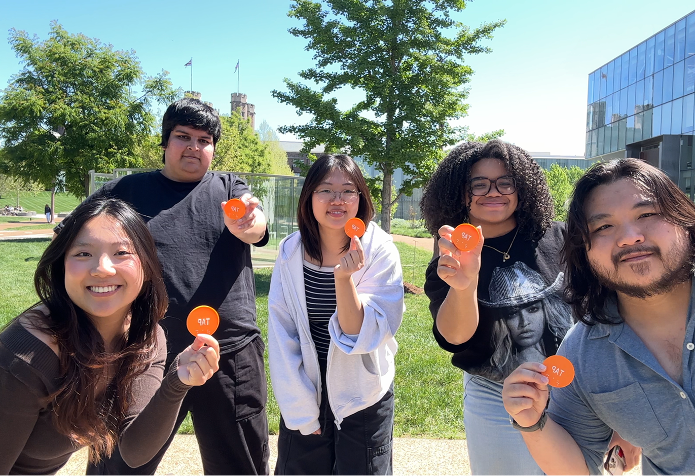
Tap to Map: a system of 3D-printed, braille-labeled NFC tags placed at key decision points along an evacuation route (refuge areas, turns, landmarks), paired with a companion app that reads turn-by-turn instructions aloud when a tag is tapped.
Where we built it
Weil Hall, using its existing tornado/severe-weather shelter protocol as the real-world test case.
Team breakdown
- Pandji + April: app design (Bluetooth beacon proximity, NFC scanning, text-to-speech)
- Ashley: route analysis and NFC content (writing the turn-by-turn audio scripts)
- Jillian + Tejas (my section): 3D-printed tag design and fabrication
Final Prototype
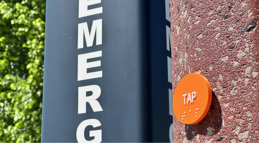
A set of orange, braille-labeled “TAP” discs mounted at decision points along a real evacuation route in Weil Hall (at an exterior entrance, near an elevator bank, and at the severe-weather refuge area), each triggering a short spoken instruction when tapped with a phone.
What it does, end to end
- Occupant feels along the wall and finds a raised, brightly colored disc marked “TAP” (both visually and in braille)
- They tap it with their phone (NFC)
- The app reads a short instruction aloud, e.g., “the bathroom is an area of refuge, keep walking until you reach the exit door”
- They continue to the next tap point, repeating until they reach shelter
Why this approach
Rather than trying to replicate a full map audibly (high cognitive load, easy to lose track of), the route is broken into small, sequential chunks: only as much information as is needed for the next few steps.
Research
Technical research
We looked into why GPS-based wayfinding doesn't work indoors:
- Satellite signal blockage from buildings, bridges, and trees
- Degraded accuracy indoors or underground
- Signal “multipath”: reflections off walls and buildings that confuse positioning
- Confirmed by comparing two location apps' logged paths in the same building: both showed noisy, inconsistent tracking indoors
This ruled out relying on GPS alone and pointed us toward tap-based, tag-anchored positioning (NFC) instead of continuous location tracking.
Secondary research
- Existing accessibility tools: tactile/braille maps (e.g., a tactile evacuation plan sign combining raised lettering, pictograms, and braille) show real demand for physical, touchable wayfinding, but they're static and can't give turn-by-turn guidance
- Existing evacuation apps: we reviewed several (e.g., WPS Evac) and found they're designed entirely around sighted use: visual floor plans, tap-to-view maps, no audio or tactile affordances
- Lived experience: Tommy Edison described having to feel along walls for a sign in unfamiliar spaces when no one is available to help; Molly Burke described tactile maps as something that let her orient immediately and said she wanted them “everywhere”
- Standard protocol: FEMA/Red Cross guidance on evacuation for people with disabilities recommends learning at least one alternate route in advance and practicing it twice a year with an “Exit Buddy.” This assumes advance learning is possible, which current tools don't really support
Insight Synthesis
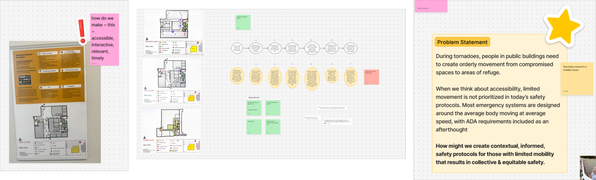
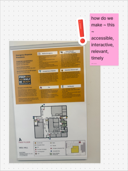
Reviewing Weil Hall's existing evacuation map surfaced three concrete accessibility gaps, which became our design requirements.
| Gap in existing map | Design requirement for Tap to Map |
|---|---|
| Posted in the exit stairway, so hard to find | Bright, tactile, distinctly shaped physical marker at each point |
| High cognitive load to parse under stress, even for sighted users | Break the route into small sequential audio chunks instead of one full map |
| Flat page, no tactile cues at all | Physical, touchable tag with braille + raised text as the primary interface |
This translated into the system's two core technical bets: NFC (not GPS) for reliable indoor positioning, and short chunked audio (not a full spoken map) to keep cognitive load low under stress.
Prototyping & Fabrication
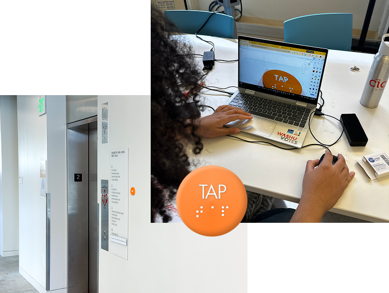
With the route mapped and audio scripts written, Tejas and I were responsible for turning “a tap point” into an actual physical object that could be installed in a building.
What that involved
- 3D design of the tag housing, sized to encase an NFC chip while staying thin and durable enough to mount on drywall, brick, or a metal pillar
- NFC compatibility testing: measuring chip dimensions and testing housing thickness to make sure the tag still read reliably once encased (NFC range degrades quickly with added material)
- Braille + raised lettering integration: designing the “TAP” label and braille dots directly into the print so they're legible by touch, not applied as a separate sticker
- Fabrication: printing and iterating on the housing
- Installation: mounting tags at the points Ashley had identified, in both indoor (drywall, near elevators) and outdoor (brick pillar) conditions
Want to dig deeper?
Happy to walk through the fabrication process, the prototype, or the decisions I didn't have room for here.
Get in touch